Sky Tiles
2017-12-14
 Click to launch
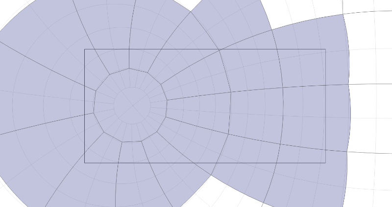
Displaying a map of the sky at high resolution requires loading and unloading files corresponding to sections of the sky (tiles). Jason Davies has a very efficient solution with a quadtree, but I think quadtrees would not work near the poles with stereographic projection. So I use a simple algorithm that works with one zoom level only (can probably be extended to 2 or 3). I load a collection of tiles (as JSON objects) that represent the files with detailed star data, and I use use the bounding box of each polygon to determine which one intersect the viewing rectangle.
Archive
- Sunset
- À la recherche du temps perdu
- Gibbon's "Decline and Fall of the Roman Empire"
- Book List
- PDF Export - Big Test
- PDF Export - Unit tests
- Precession
- Planet Path - Ecliptic projection
- Ecliptic Projection
- Planet Path
- Zodiac
- Date and time input
- Moon Position
- Hourglass Diagram
- Moon Distance
- Deep Sky Objects
- Sunrise
- Moon Calendar
- Drawing the Moon
- Sky Tiles
- Asteroids and comets
- Variable-width lines
- Solar System 3D representations
- Horizon